


Getting Here
Directions, Road Conditions, Parking, & Shuttles


Real-Time Lot Status
Get real-time parking status for Snow Valley, Snow Summit, and Bear Mountain.
Download App
 rich-text, responsive-table
Get real-time parking status for Snow Valley, Snow Summit, and Bear Mountain.
Download App
rich-text, responsive-table
![]()
![]()
![]()
Big Bear Mountain Resort does not manage or own the roads to Big Bear Lake, CA.
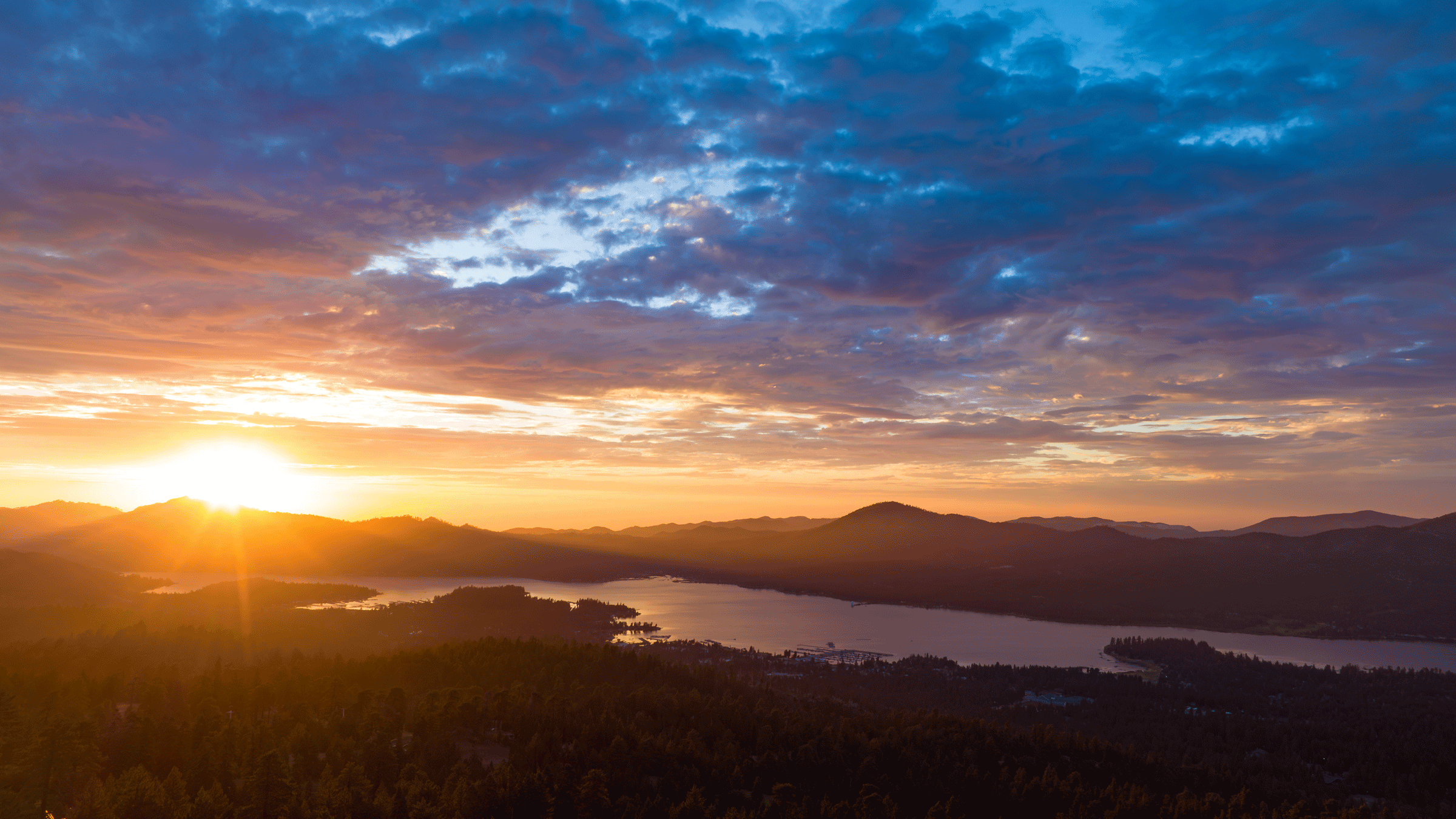
Nestled in the heart of the San Bernardino National Forest, Big Bear Mountain Resort is a short, scenic drive from most Southern California locations. Explore this page to learn how to get here safely, where to park, and more at Snow Valley, Snow Summit, and Bear Mountain.
Know Where to Go
Plan Ahead & Get on the Hill Quicker
 rich-text, responsive-table
For up-to-date information or question, please contact CalTrans at www.dot.ca.gov. CHP and CalTrans do not allow vehicles over 40’ in length on some roads and state highways. Learn more about bus restrictions.
rich-text, responsive-table
-
Directions
When heading up and down from Running Springs or Big Bear Lake, stay on primary roads/highways and follow all directional signage and staff instructions when you arrive as traffic/parking routes may differ from your GPS system. rich-text, responsive-tableSnow Valley
35100 CA-18
Running Springs, CA 92382
Open in Google Maps
Location serves: Ski & Snowboarding, snow play area, Coyote Creek Tube Park, lift-served Bike Park, hiking, Scenic Sky Chair rich-text, responsive-table{"enabled":true,"publicToken":"pk.eyJ1IjoiYWx0ZXJyYW10bmNvIiwiYSI6ImNrOHVsZXFxMDBjZzgzbnBhYWxwY3d1Mm8ifQ.Qcn9ejNANCtDkHlzwM0uAQ","style":"mapbox://styles/alterramtnco/clw85gecq005u01rd7cit5lig","defaultLatitude":"44.5015671","defaultLongitude":"-80.3235376","locations":[{"latitude":"34.2253412","longitude":"-117.0360852","address":"35100 State Highway 18, Running Springs, CA 92382","displayName":"Snow Valley","iconUrl":null,"iconSource":"<svg version=\"1.1\" id=\"Layer_1\" xmlns=\"http://www.w3.org/2000/svg\" x=\"0\" y=\"0\" viewBox=\"0 0 20 20\" style=\"enable-background:new 0 0 20 20\" xml:space=\"preserve\"><style>.st0{fill:#c12336}.st2{fill:#b9a590}.st3{fill:#e0d6ca}.st4{font-family:'Gotham-Bold'}.st5{font-size:.8909px}</style><path class=\"st0\" d=\"M4.34 6.1c0 3.01 2.83 5.81 5.81 13.63 2.98-7.82 5.81-10.63 5.81-13.63 0-3.21-2.6-5.81-5.81-5.81-3.2 0-5.81 2.6-5.81 5.81zm5.82 2.98c-1.65 0-2.98-1.33-2.98-2.98s1.33-2.98 2.98-2.98 2.98 1.33 2.98 2.98-1.34 2.98-2.98 2.98zm-3.25 2.27C5.71 9.08 4.92 7.58 4.92 6.1c0-2.89 2.35-5.24 5.24-5.24v1.68C8.2 2.54 6.6 4.14 6.6 6.1s1.6 3.56 3.56 3.56v8.5s-2.32-5.05-3.25-6.81z\"/><path d=\"M6.91 11.35C5.71 9.08 4.92 7.58 4.92 6.1c0-2.89 2.35-5.24 5.24-5.24v1.68C8.2 2.54 6.6 4.14 6.6 6.1s1.6 3.56 3.56 3.56v8.5s-2.32-5.05-3.25-6.81z\" style=\"fill:#ec2227\"/><path class=\"st2\" d=\"m7.28 12.08 3.36 6.06h-.91l3.31-6.06-2.4 6.48-.45 1.21-.46-1.21-2.45-6.48z\"/><path class=\"st3\" d=\"m8.95 15.43 1.66 2.17h-.89l1.64-2.17-.75 2.62-.44 1.55c-.27-.95-.93-3.21-1.22-4.17zM10.16 9.08c-1.65 0-2.98-1.33-2.98-2.98s1.33-2.98 2.98-2.98 2.98 1.33 2.98 2.98-1.34 2.98-2.98 2.98z\"/><path class=\"st2\" d=\"M10.19 9.13c-4.71.08-4.41-6.46 0-6.28 4.11.58 4.64 6.23 0 6.28zm0-.1c3.09-.1 3.53-6.03 0-5.64-3.15.37-3.13 5.38 0 5.64z\"/><text transform=\"translate(8.672 5.918)\"><tspan x=\"0\" y=\"0\" class=\"st0 st4 st5\">SNOW</tspan><tspan x=\"-.34\" y=\".94\" class=\"st0 st4 st5\">VALLEY</tspan></text></svg>\n","iconClass":"","iconColor":"","iconHeight":20,"iconWidth":20,"isValid":true}]} map-box-componentSnow Summit
880 Summit Blvd
Big Bear Lake, CA 92315
Open in Google Maps
Location serves: Ski & Snowboarding, lift-served Bike Park, Basecamp Activities, Grizzly Ridge Tube Park, hiking, Scenic Sky Chair rich-text, responsive-table{"enabled":true,"publicToken":"pk.eyJ1IjoiYWx0ZXJyYW10bmNvIiwiYSI6ImNrOHVsZXFxMDBjZzgzbnBhYWxwY3d1Mm8ifQ.Qcn9ejNANCtDkHlzwM0uAQ","style":"mapbox://styles/alterramtnco/clw85gecq005u01rd7cit5lig","defaultLatitude":"44.5015671","defaultLongitude":"-80.3235376","locations":[{"latitude":"34.236566","longitude":"-116.8893284","address":"880 Summit Blvd., Big Bear Lake, California 92315","displayName":"Snow Summit","iconUrl":null,"iconSource":"<svg version=\"1.1\" id=\"Layer_1\" xmlns=\"http://www.w3.org/2000/svg\" x=\"0\" y=\"0\" viewBox=\"0 0 60 60\" style=\"enable-background:new 0 0 60 60\" xml:space=\"preserve\"><style>.st0{fill:#c12035}.st2{fill:#b8a58f}.st3{fill:#e0d6ca}.st4{display:none}.st5{display:inline;fill:#c12035}.st6{font-family:'Gotham-Bold'}.st7{font-size:2.3823px}</style><path class=\"st0\" d=\"M15.45 20.95c0 8.04 7.58 15.55 15.55 36.45 7.97-20.9 15.55-28.41 15.55-36.45C46.55 12.37 39.59 5.4 31 5.4s-15.55 6.97-15.55 15.55zM31 28.92c-4.4 0-7.97-3.57-7.97-7.97s3.57-7.97 7.97-7.97 7.97 3.57 7.97 7.97-3.57 7.97-7.97 7.97zM22.32 35C19.11 28.92 17 24.91 17 20.95c0-7.72 6.28-14 14-14v4.49c-5.25 0-9.51 4.27-9.51 9.51 0 5.25 4.27 9.51 9.51 9.51V53.2S24.81 39.71 22.32 35z\"/><path d=\"M22.32 35C19.11 28.92 17 24.91 17 20.95c0-7.72 6.28-14 14-14v4.49c-5.25 0-9.51 4.27-9.51 9.51 0 5.25 4.27 9.51 9.51 9.51V53.2S24.81 39.71 22.32 35z\" style=\"fill:#ed1c24\"/><path class=\"st2\" d=\"M23.29 36.93c1.48 2.71 2.87 5.46 4.23 8.23 1.38 2.76 2.68 5.55 3.99 8.34h-.91c1.28-2.79 2.57-5.58 3.93-8.34l2.04-4.14c.71-1.36 1.39-2.74 2.13-4.09-.53 1.44-1.13 2.86-1.69 4.3l-1.78 4.25c-1.19 2.83-2.45 5.64-3.71 8.44l-.45 1-.46-1c-1.28-2.8-2.57-5.6-3.78-8.44-1.22-2.83-2.43-5.67-3.54-8.55z\"/><path class=\"st3\" d=\"m27.78 45.89 3.69 6.18h-.89l3.64-6.18-2.75 6.63-.44 1.07-.45-1.07zM31 28.92c-4.4 0-7.97-3.57-7.97-7.97s3.57-7.97 7.97-7.97 7.97 3.57 7.97 7.97-3.57 7.97-7.97 7.97z\"/><path class=\"st2\" d=\"M31.08 28.97c-2.06.01-4.18-.72-5.76-2.2-1.61-1.44-2.52-3.63-2.53-5.82-.02-2.2.89-4.38 2.43-5.92 1.52-1.57 3.72-2.43 5.86-2.32 4.3.15 8.02 3.86 8.18 8.24.07 2.16-.83 4.37-2.43 5.81-1.57 1.48-3.69 2.21-5.75 2.21zm0-.1c2.07.03 4.03-1.02 5.3-2.54a8.885 8.885 0 0 0 2.05-5.38c.08-1.95-.55-4-1.94-5.48a6.984 6.984 0 0 0-5.4-2.21c-1.99.09-3.87 1-5.18 2.43-1.32 1.42-2.03 3.35-2.04 5.27-.02 1.93.68 3.84 1.94 5.37 1.24 1.51 3.21 2.56 5.27 2.54z\"/><path class=\"st0\" d=\"M8.81-48.47h3.43c2 0 3.21 1.19 3.21 2.9v.02c0 1.94-1.51 2.95-3.39 2.95h-1.4v2.52H8.81v-8.39zm3.31 4.23c.92 0 1.46-.55 1.46-1.27v-.02c0-.83-.58-1.27-1.5-1.27h-1.43v2.57h1.47z\"/><text transform=\"translate(26.947 20.953)\"><tspan x=\"0\" y=\"0\" class=\"st0 st6 st7\">SNOW</tspan><tspan x=\"-.85\" y=\"2.5\" class=\"st0 st6 st7\">SUMMIT</tspan></text></svg>\n","iconClass":"","iconColor":"","iconHeight":20,"iconWidth":20,"isValid":true}]} map-box-componentBear Mountain
43101 Goldmine Drive
Big Bear Lake, CA 92315
Open in Google Maps
Location serves: Ski & Snowboarding, Bear Mountain Golf Course & Driving Range (across the parking lot) rich-text, responsive-table{"enabled":true,"publicToken":"pk.eyJ1IjoiYWx0ZXJyYW10bmNvIiwiYSI6ImNrOHVsZXFxMDBjZzgzbnBhYWxwY3d1Mm8ifQ.Qcn9ejNANCtDkHlzwM0uAQ","style":"mapbox://styles/alterramtnco/clw85gecq005u01rd7cit5lig","defaultLatitude":"44.5015671","defaultLongitude":"-80.3235376","locations":[{"latitude":"34.2280803","longitude":"-116.8608571","address":"43101 Goldmine Drive, Big Bear Lake, California 92315","displayName":"Bear Mountain","iconUrl":null,"iconSource":"<svg version=\"1.1\" id=\"Layer_1\" xmlns=\"http://www.w3.org/2000/svg\" x=\"0\" y=\"0\" viewBox=\"0 0 60 60\" style=\"enable-background:new 0 0 60 60\" xml:space=\"preserve\"><style>.st0{fill:#c12035}.st2{fill:#b8a58f}.st3{fill:#e0d6ca}.st4{display:none}.st5{display:inline;fill:#c12035}.st6{font-family:'Gotham-Bold'}.st7{font-size:2.3823px}</style><path class=\"st0\" d=\"M15.45 20.95c0 8.04 7.58 15.55 15.55 36.45 7.97-20.9 15.55-28.41 15.55-36.45C46.55 12.37 39.59 5.4 31 5.4s-15.55 6.97-15.55 15.55zM31 28.92c-4.4 0-7.97-3.57-7.97-7.97s3.57-7.97 7.97-7.97 7.97 3.57 7.97 7.97-3.57 7.97-7.97 7.97zM22.32 35C19.11 28.92 17 24.91 17 20.95c0-7.72 6.28-14 14-14v4.49c-5.25 0-9.51 4.27-9.51 9.51 0 5.25 4.27 9.51 9.51 9.51V53.2S24.81 39.71 22.32 35z\"/><path d=\"M22.32 35C19.11 28.92 17 24.91 17 20.95c0-7.72 6.28-14 14-14v4.49c-5.25 0-9.51 4.27-9.51 9.51 0 5.25 4.27 9.51 9.51 9.51V53.2S24.81 39.71 22.32 35z\" style=\"fill:#ed1c24\"/><path class=\"st2\" d=\"M23.29 36.93c1.48 2.71 2.87 5.46 4.23 8.23 1.38 2.76 2.68 5.55 3.99 8.34h-.91c1.28-2.79 2.57-5.58 3.93-8.34l2.04-4.14c.71-1.36 1.39-2.74 2.13-4.09-.53 1.44-1.13 2.86-1.69 4.3l-1.78 4.25c-1.19 2.83-2.45 5.64-3.71 8.44l-.45 1-.46-1c-1.28-2.8-2.57-5.6-3.78-8.44-1.22-2.83-2.43-5.67-3.54-8.55z\"/><path class=\"st3\" d=\"m27.78 45.89 3.69 6.18h-.89l3.64-6.18-2.75 6.63-.44 1.07-.45-1.07zM31 28.92c-4.4 0-7.97-3.57-7.97-7.97s3.57-7.97 7.97-7.97 7.97 3.57 7.97 7.97-3.57 7.97-7.97 7.97z\"/><path class=\"st2\" d=\"M31.08 28.97c-2.06.01-4.18-.72-5.76-2.2-1.61-1.44-2.52-3.63-2.53-5.82-.02-2.2.89-4.38 2.43-5.92 1.52-1.57 3.72-2.43 5.86-2.32 4.3.15 8.02 3.86 8.18 8.24.07 2.16-.83 4.37-2.43 5.81-1.57 1.48-3.69 2.21-5.75 2.21zm0-.1c2.07.03 4.03-1.02 5.3-2.54a8.885 8.885 0 0 0 2.05-5.38c.08-1.95-.55-4-1.94-5.48a6.984 6.984 0 0 0-5.4-2.21c-1.99.09-3.87 1-5.18 2.43-1.32 1.42-2.03 3.35-2.04 5.27-.02 1.93.68 3.84 1.94 5.37 1.24 1.51 3.21 2.56 5.27 2.54z\"/><path class=\"st0\" d=\"M8.81-48.47h3.43c2 0 3.21 1.19 3.21 2.9v.02c0 1.94-1.51 2.95-3.39 2.95h-1.4v2.52H8.81v-8.39zm3.31 4.23c.92 0 1.46-.55 1.46-1.27v-.02c0-.83-.58-1.27-1.5-1.27h-1.43v2.57h1.47zM27.74 18.74h.77c.19 0 .34.05.44.15.08.08.11.17.11.28 0 .19-.1.29-.22.36.19.07.31.19.31.41 0 .3-.25.46-.62.46h-.79v-1.66zm.96.5c0-.11-.09-.17-.24-.17h-.36v.35h.34c.16 0 .26-.06.26-.18zm-.18.48h-.42v.37h.44c.16 0 .26-.06.26-.18-.01-.12-.09-.19-.28-.19zM29.46 18.74h1.26v.33h-.89v.34h.79v.33h-.79v.35h.9v.33h-1.27v-1.68zM31.63 18.73h.34l.71 1.68h-.38l-.15-.37h-.7l-.15.37h-.37l.7-1.68zm.38.98-.22-.54-.22.54h.44zM32.94 18.74h.76c.21 0 .38.06.49.17.09.09.14.22.14.38 0 .27-.14.44-.36.52l.41.6h-.43l-.36-.53h-.29v.53h-.37v-1.67zm.73.81c.18 0 .28-.1.28-.24 0-.16-.11-.24-.29-.24h-.36v.48h.37zM24.36 20.74h.4l.44.7.44-.7h.4v1.67h-.36v-1.09l-.47.71h-.01l-.46-.7v1.08h-.36v-1.67zM26.36 21.58c0-.48.37-.87.89-.87s.88.38.88.86c0 .47-.37.86-.89.86s-.88-.37-.88-.85zm1.39 0c0-.29-.21-.53-.5-.53s-.5.23-.5.52c0 .29.21.52.5.52.29.01.5-.22.5-.51zM28.43 21.7v-.95h.37v.94c0 .27.14.41.36.41s.36-.14.36-.4v-.95h.37v.94c0 .5-.28.75-.73.75s-.73-.25-.73-.74zM30.26 20.74h.34l.78 1.03v-1.03h.36v1.67h-.31l-.81-1.06v1.06h-.36v-1.67zM32.53 21.08h-.51v-.34h1.38v.34h-.51v1.33h-.37v-1.33zM34.04 20.73h.34l.71 1.68h-.38l-.15-.37h-.71l-.15.37h-.37l.71-1.68zm.39.98-.22-.54-.22.54h.44zM35.37 20.74h.37v1.67h-.37v-1.67zM36.15 20.74h.34l.78 1.03v-1.03h.36v1.67h-.31l-.81-1.06v1.06h-.36v-1.67z\"/></svg>\n","iconClass":"","iconColor":"","iconHeight":20,"iconWidth":20,"isValid":true}]} map-box-component -
Multiple Ways To & From
There are multiple ways to get up to Big Bear Mountain Resort. Choose your route according to your starting location, weather, and road conditions. rich-text, responsive-table
Hwy 330 to Hwy 18 RS
Shortest Distance
The shortest and quickest way for visitors coming from Los Angeles, Orange County, and other points west is Hwy 330 / Hwy 18 through Running Springs. Please note that this route can become very congested on the weekends during peak season.
Hwy 18 RS
Alternative Route Avoiding Hwy 330
This is a great alternative route for visitors coming from the West. Hwy 18 through Running Springs bypasses Hwy 330 and connects straight through to Big Bear Lake and vice versa.
Hwy 38
Scenic Route, Less Switchbacks
Though the drive on this route takes a bit longer (approx 20 minutes), it is typically less congested than Hwy 330 / Hwy 18. This route will take you the back way through Redlands.
Hwy 18 LV
Travel Through Lucerne Valley
Hwy 18 is the quickest way to/from Barstow, Las Vegas, and other high desert locations. This route has the least amount of mountain driving.


Catch a Weekend Ride From LA/OC
Schedule and pricing will be announced in November 2026.
Catch a ride to Snow Summit during the 26/27 winter season with the Sports Basement Ski Bus. For $80 per seat per day, you can depart from South Bay, Long Beach, or Orange County on select Saturdays and Sundays. Pricing and dates subject to change at any time.
Catch a ride to Snow Summit during the 26/27 winter season with the Sports Basement Ski Bus. For $80 per seat per day, you can depart from South Bay, Long Beach, or Orange County on select Saturdays and Sundays. Pricing and dates subject to change at any time.

Directions
3 Ways Up & 3 Ways Home
Close Video
Directions
3 Ways Up & 3 Ways Home
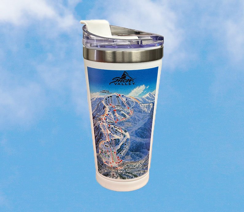
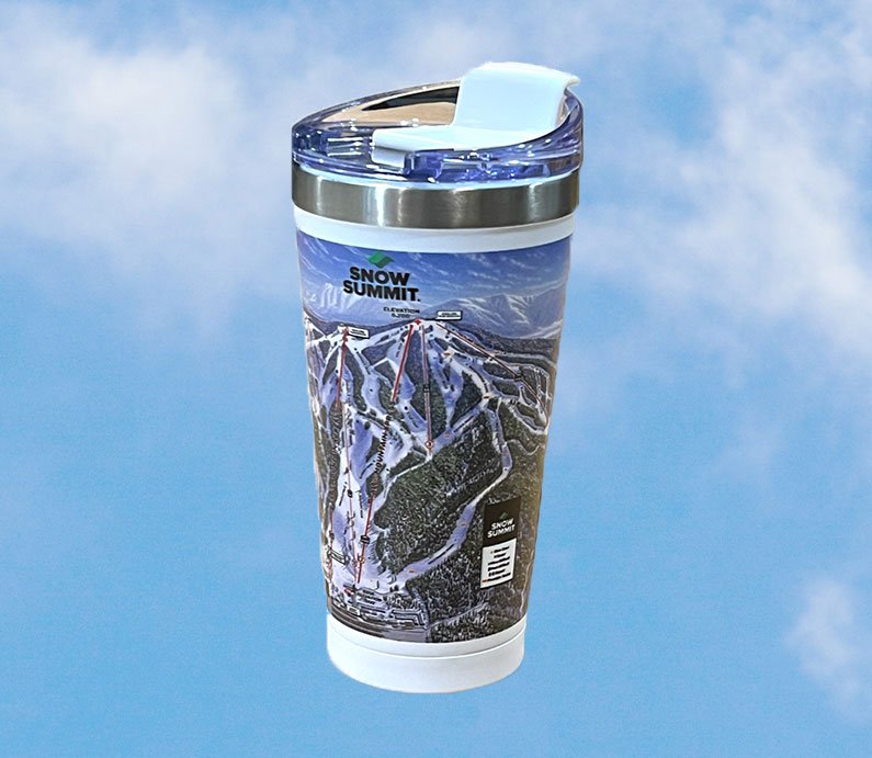
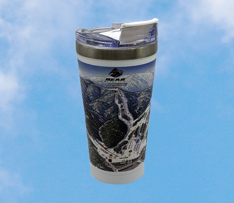
Drive Comfortably with these Souvenirs
rich-text, responsive-table
 rich-text, responsive-table
 rich-text, responsive-table
 rich-text, responsive-table

Gift Cards
Thinking of giving lift tickets or BBMR branded clothing as a gift? Purchase a gift card instead and allow them to choose what they like.
 rich-text, responsive-table