


Trail Maps
Know Where to Go
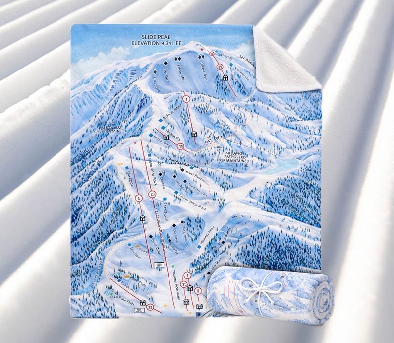
Plan your outdoor adventure with Big Bear Mountain Resort trail maps below. To explore trails in the winter, just click on the upper-right icon of the maps to access the legend. From there you can choose to view lifts, terrain parks, and trails by rating type. You can also view real-time updates on the lift & trail status.
In effort to reduce carbon footprint, printed paper trail maps are not available. Download the BBMR Mobile App to access the trail maps digitally. rich-text, responsive-table
In effort to reduce carbon footprint, printed paper trail maps are not available. Download the BBMR Mobile App to access the trail maps digitally. rich-text, responsive-table
-
Lift-Served Summer Oasis
Snow Valley is home to the oldest continually operating ski resort in Southern California and during the summer months, turns into a lift served bike haven. From mountain biking to hiking with breathtaking views, Snow Valley offers beginner, intermediate, and advanced downhill terrain for riders of all ages and ability levels. Ride up Snow Valley Express, California's first high-speed 6 person chairlift, then enjoy a day on the trails. rich-text, responsive-tablecarousel-component
rich-text, responsive-tableSnow Valley Bike Park Terrain Stats MTB Acres 3.4 Lifts 1 Trails 10 Longest Run (Green Horn) 1.1 mi/1.8 km Difficulty Breakdown 20% Beginner
50% Intermediate
30% AdvancedBase Elevation 6,800 ft/2,072 m Peak Elevation 7,841 ft/2,380 m Vertical Drop 1,041 ft/317 m Shop Alpine Items rich-text, responsive-table rich-text, responsive-table
 rich-text, responsive-table
 rich-text, responsive-table

Gift Cards
Thinking of giving lift tickets or BBMR branded clothing as a gift? Purchase a gift card instead and allow them to choose what they like. -
Diverse Mixture of Trails
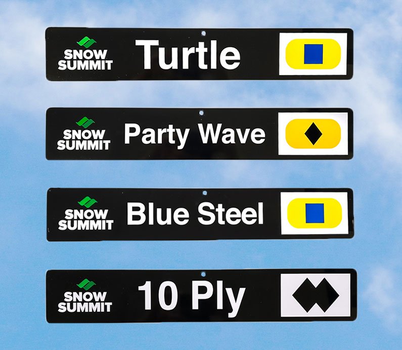
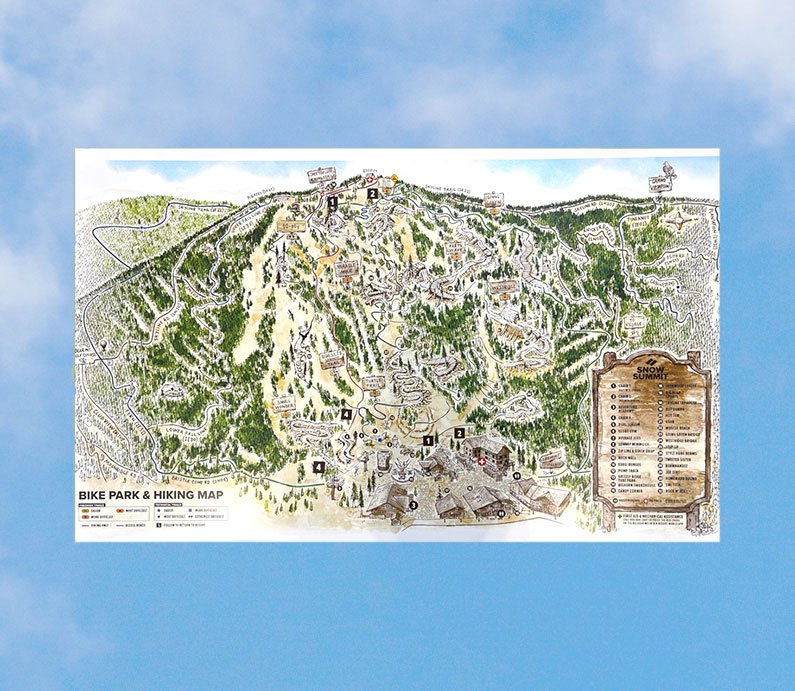
Snow Summit is home to Southern California’s premier lift-served, gravity fed bike park, with trails and terrain for riders of all ages and ability levels. Featuring beginner, intermediate, and advanced downhill trails, Skill Builder Park with Jump, Pro, and Pump lines, and access to miles of cross-country trails.
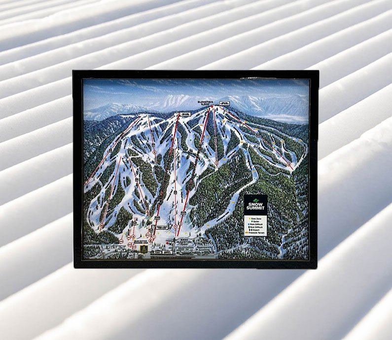
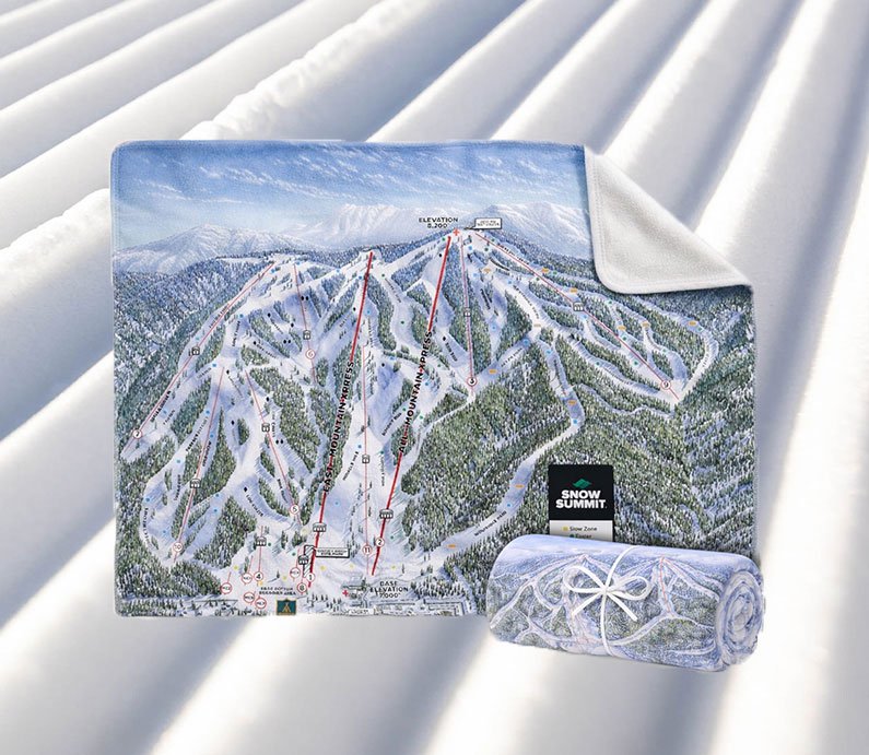
Snow Summit trail map posters are available to purchase online. rich-text, responsive-tablecarousel-component
rich-text, responsive-tableSummit Bike Park Terrain Stats MTB Acres 10 + Access to Miles of XC Lifts 3 Trails 11 Longest Run (Going Green) 3.4 mi/5.5 km Difficulty Breakdown 50% Beginner
10% Intermediate
40% AdvancedBase Elevation 7,000 ft/2,133 m Peak Elevation 8,200 ft/2,499 m Vertical Drop 1,200 ft/365 m carousel-component Adopt-a-Trail Program
Snow Summit adopted several trails that skirt our bike park including Pirates, Lower Skyline, Upper and Lower Fall Line and Dickies Trails. We are committed to the maintenance of these trails each summer.
rich-text, responsive-tableShop Summer Trail Items rich-text, responsive-table rich-text, responsive-table
 rich-text, responsive-table
 rich-text, responsive-table
Gift Cards
Thinking of giving lift tickets or BBMR branded clothing as a gift? Purchase a gift card instead and allow them to choose what they like. -
Nine-Hole Golf Course
Bear Mountain Golf Course offers a true alpine setting with Ponderosa pines, mountaintop vistas, and a pastoral 9-hole, par 35-course layout. rich-text, responsive-tablecarousel-component
rich-text, responsive-tableBear Mountain Golf Course Terrain Stats Topography Rolling Hills
Tree-Lined FairwaysGreens Bent Grass
Poa Annua GrassTees Rye Grass Practice Driving Range
Putting Area
Chipping AreaShop Golf Items rich-text, responsive-table rich-text, responsive-table
 rich-text, responsive-table
 rich-text, responsive-table

Gift Cards
Thinking of giving lift tickets or BBMR branded clothing as a gift? Purchase a gift card instead and allow them to choose what they like. -
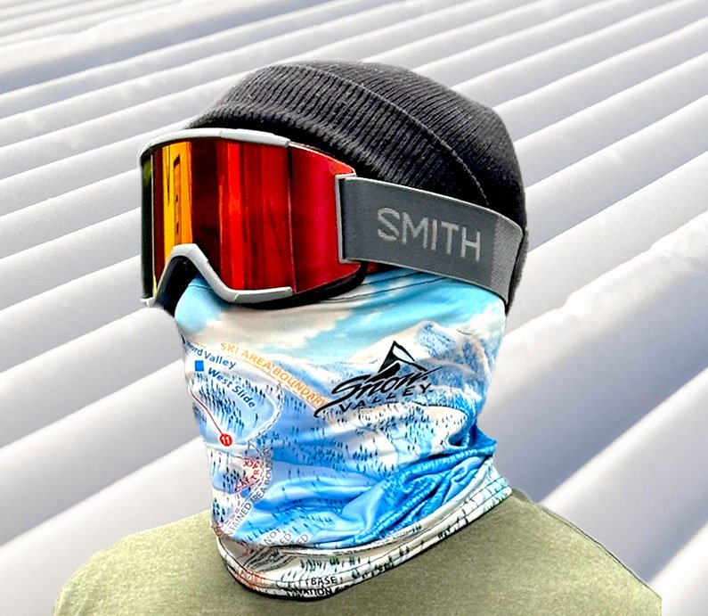
A Treasured Destination Since 1937
Snow Valley offers two sections of the mountain when fully open with plenty of terrain for all levels of skiers and snowboarders plus Southern California’s only chairlift serviced snow tubing and snow play area.
Snow Valley trail map magnets are available to purchase online. rich-text, responsive-table
rich-text, responsive-tableSnow Valley Terrain Stats Base Elevation 6,800 ft/2,072 m Peak Elevation 7,841 ft/2,380 m Vertical Drop 1,041 ft/317 m Trails/Runs 32 Longest Run (Bubble Gum) 0.47 mi/0.76 km Lifts 9 Difficulty Breakdown 14% Beginner
45% Intermediate
41% Advancedcarousel-component


 #ValleyViews Terrain Parks
Snow Valley presents distinctive and enjoyable iconic park trails, exemplified by The EDGE. Here, you can experience the ideal slope, a lengthy and exciting run with a variety of cool options. Another notable attraction is The Hideout, an excellent hiking park situated just above Deer Meadow Grill’s deck and bar—a perfect spot for contests or simply to unwind. The East Bowl, the trail adjacent to The Hideout, guides you to this location, though it lacks additional features. Additionally, we offer Chair 13 Park, specifically designed for beginners, featuring a gentle slope to prepare you for the thrill of The EDGE.
rich-text, responsive-tableShop Winter Trail Items rich-text, responsive-table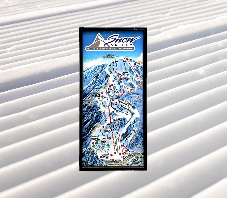 rich-text, responsive-table
 rich-text, responsive-table
 rich-text, responsive-table

Gift Cards
Thinking of giving lift tickets or BBMR branded clothing as a gift? Purchase a gift card instead and allow them to choose what they like. -
SoCal's Snow Capital
Drop in at 8,200 feet and experience the best that Southern California has to offer. With over 240 acres of skiable terrain and 33 trails of all ability levels, Snow Summit boasts 18+ skiable miles. Covered with a state-of-the-art snowmaking system and 11 chair lifts, Snow Summit is where SoCal skis and rides.
Snow Summit trail map posters are available to purchase online. rich-text, responsive-table
rich-text, responsive-tableSnow Summit Terrain Stats Base Elevation 7,000 ft/2,133 m Peak Elevation 8,200 ft/2,499 m Vertical Drop 1,200 ft/365 m Trails/Runs 33 Longest Run (Westridge) 1.25 mi/2 km Lifts 10 Difficulty Breakdown 35% Beginner/Low Intermediate
40% Intermediate
25% Advanced/Expertcarousel-component


 #SummitStyle Terrain Parks
Snow Summit's terrain parks are filled with diverse boxes, tubes, snow features, and more. Located to the right of the slopes, check out the Skill Builder and Freestyle Parks for weekly updates of family-fun features.
rich-text, responsive-tableShop Winter Trail Items rich-text, responsive-table rich-text, responsive-table
 rich-text, responsive-table
 rich-text, responsive-table
Gift Cards
Thinking of giving lift tickets or BBMR branded clothing as a gift? Purchase a gift card instead and allow them to choose what they like. -
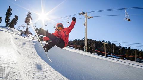
Home to SoCal's Only Halfpipes
Home to award winning terrain parks and 748 permitted acres, Bear Mountain is Southern California’s epicenter for progression and development in snow sports. Bear is also home to the largest learning area in SoCal. From our terrain-based learning area to our Skill Builder Parks, we teach people to ski and ride everyday of the season. Bear is also home to SoCal’s only halfpipes, thanks to our state-of-the-art grooming and snowmaking. That’s why Southern California skiers and riders from all over the world head to the parks and slopes of Bear.
For the winter 25/26 season, the progression continues at Bear Mountain with the newest Midway lift, which opened in mid-December 2024. The high-speed 6-seat lift replaced chairs 2 and 5 in the central base area to provide better uphill capacity and easier access to the mid-mountain progression terrain so guests can enjoy shorter lift lines and more time on the slopes. Read the announcement. rich-text, responsive-table
rich-text, responsive-tableBear Mountain Terrain Stats Base Elevation 7,140 ft/2,176 m Peak Elevation 8,805 ft/2,683 m Vertical Drop 1,665 ft/507 m Developed Acres 198 Trails/Runs 26 Longest Run (Geronimo) 1.5 mi/2.4 km Pipes 2 Lifts 7 Difficulty Breakdown 30% Beginner/Low Intermediate
40% Intermediate
30% Advanced/Expertcarousel-component


 #BearBuilt Terrain Parks
Bear Mountain's terrain parks are perennially rated among the best in the country thanks to our award-winning Park Crew's dedication to constantly push the limit of what's possible when it comes to park progression.
rich-text, responsive-tableShop Winter Trail Items rich-text, responsive-table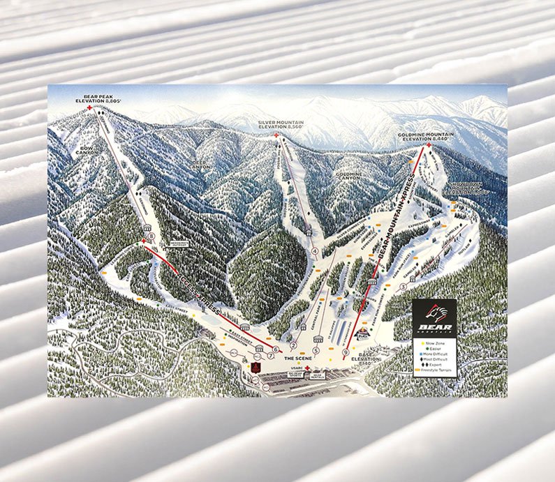 rich-text, responsive-table
 rich-text, responsive-table
 rich-text, responsive-table
Gift Cards
Thinking of giving lift tickets or BBMR branded clothing as a gift? Purchase a gift card instead and allow them to choose what they like.


